During Maja’s week-long stay in Iceland, we went on two one-day trips—two of the most popular excursions on the island: Golden Circle (6h) and South Coast & Jökulsárlón Glacier Lagoon (14h).
I’ll introduce them together.
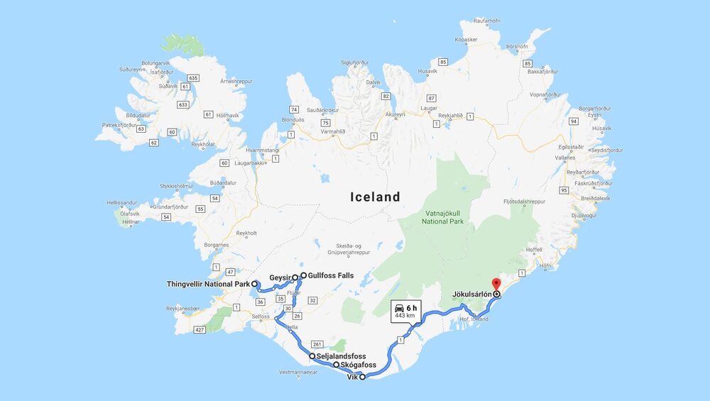
This is what the combined route of both days would look like.
Enjoy! 😉
DAY 1: Golden Circle Classic
Þingvellir
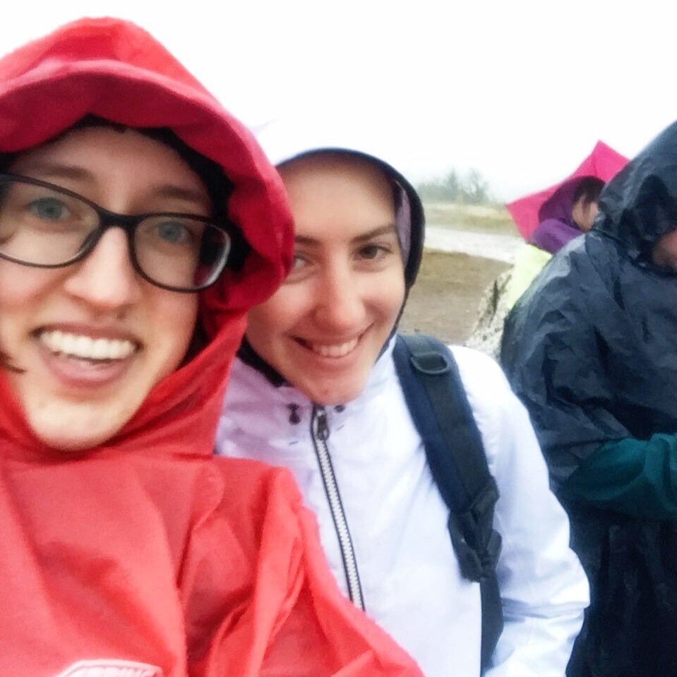
The day started off pretty miserably—rain was already falling in Reykjavík, and the weather didn’t improve on the way. The rain wasn’t heavy, but it was enough to get you soaked—especially because it felt like it wasn’t even raining that much.
Because of the conditions, I left my camera in the bus and tried to snap at least a few decent photos with my phone.
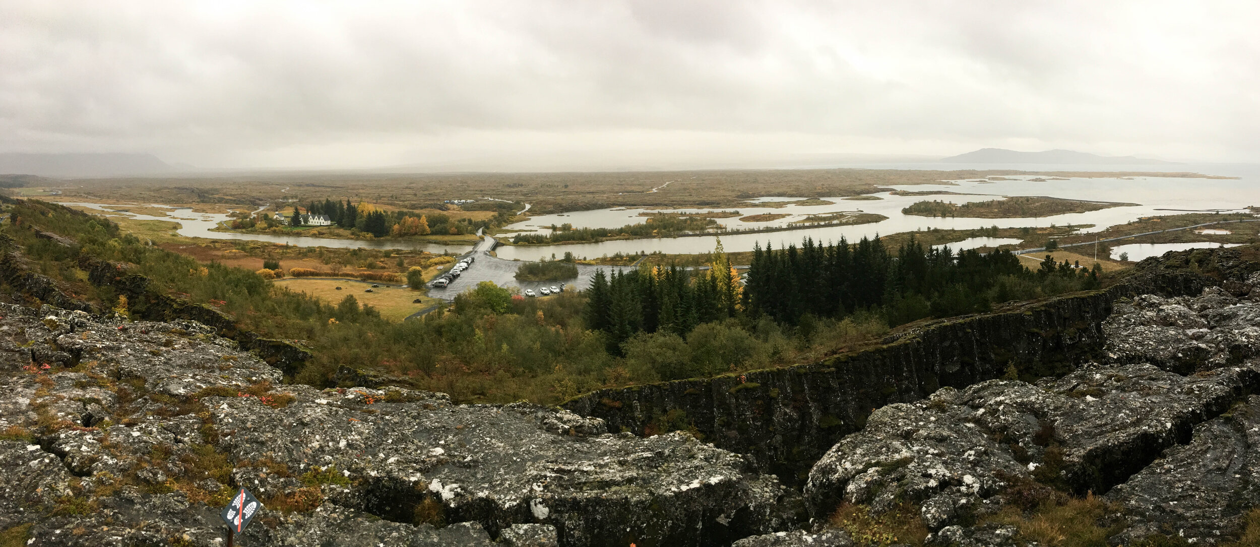
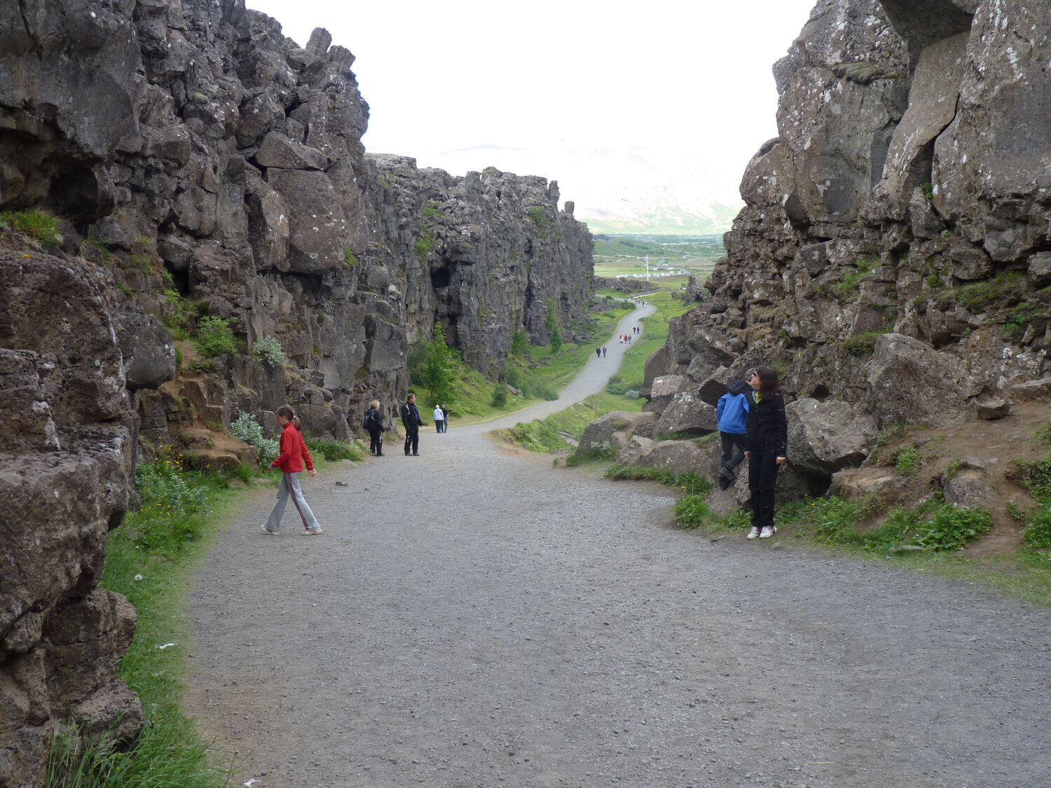
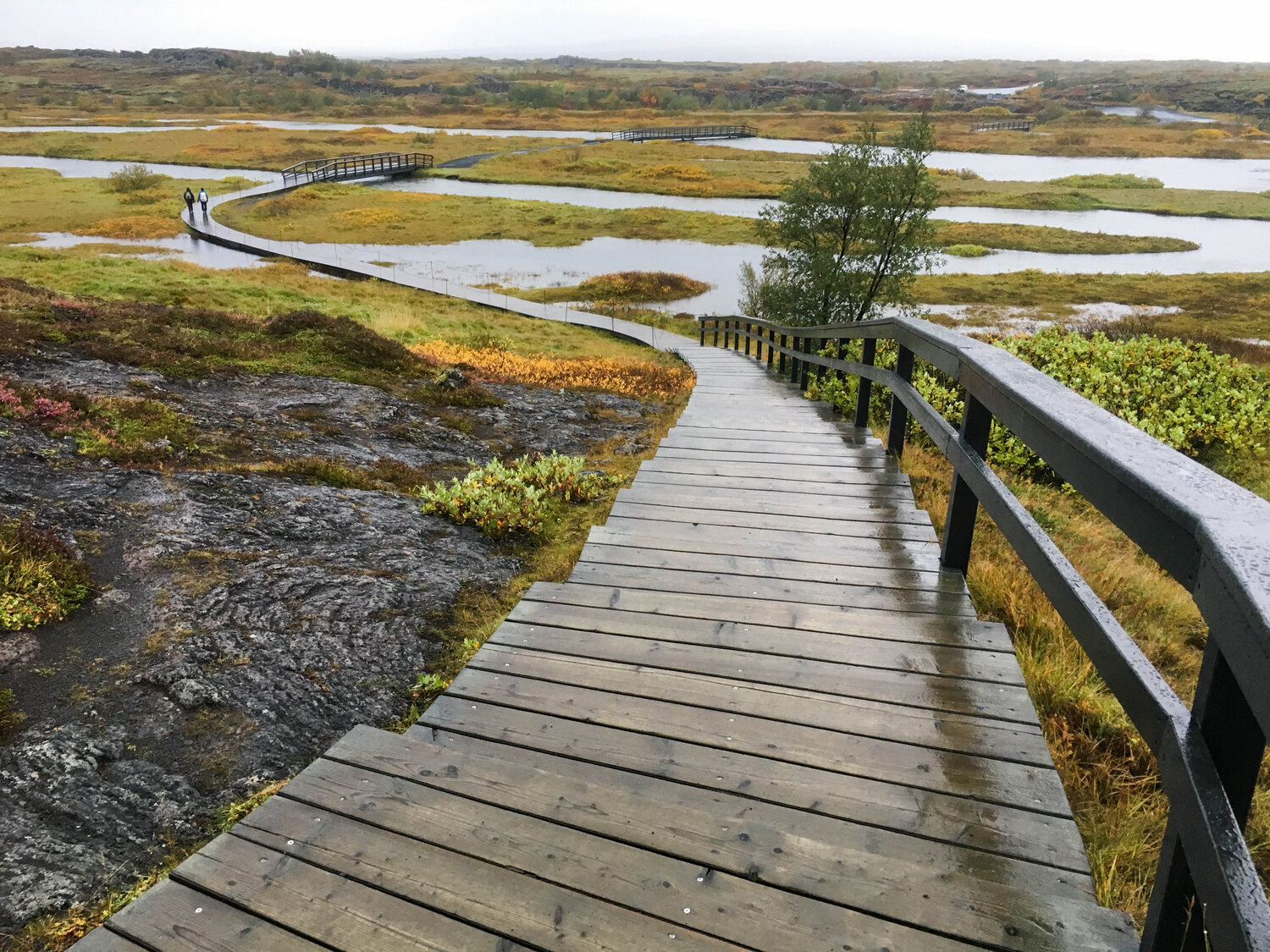
Our first stop—already familiar to me—was Þingvellir National Park, where just weeks earlier, I had swum in the crystal-clear Silfra fissure.
When I visited with my family, we thought the narrow gorge here marked the rift between the North American and Eurasian tectonic plates. But it doesn’t! The entire park is part of the rift zone, where the plates are drifting apart at a rate of 2 cm per year—there’s no single, visible crack between them.
If you look closely, you can see a deep trench beneath the wooden walkway—this wasn’t here in 2011. Apparently, an earthquake about a decade ago caused underground shifts, creating a hollow space below the path. For safety reasons, the walkway was reconstructed over this new gap.
Before, it looked like this:
Beyond its geological significance, Þingvellir is an important historical site for Icelanders. In 930, Norwegian Vikings established the world’s first democratic parliament here, making Iceland the first democratic republic. There was no executive power—everything was decided by the community. Later, Iceland fell under Danish rule and only gained independence in 1944.
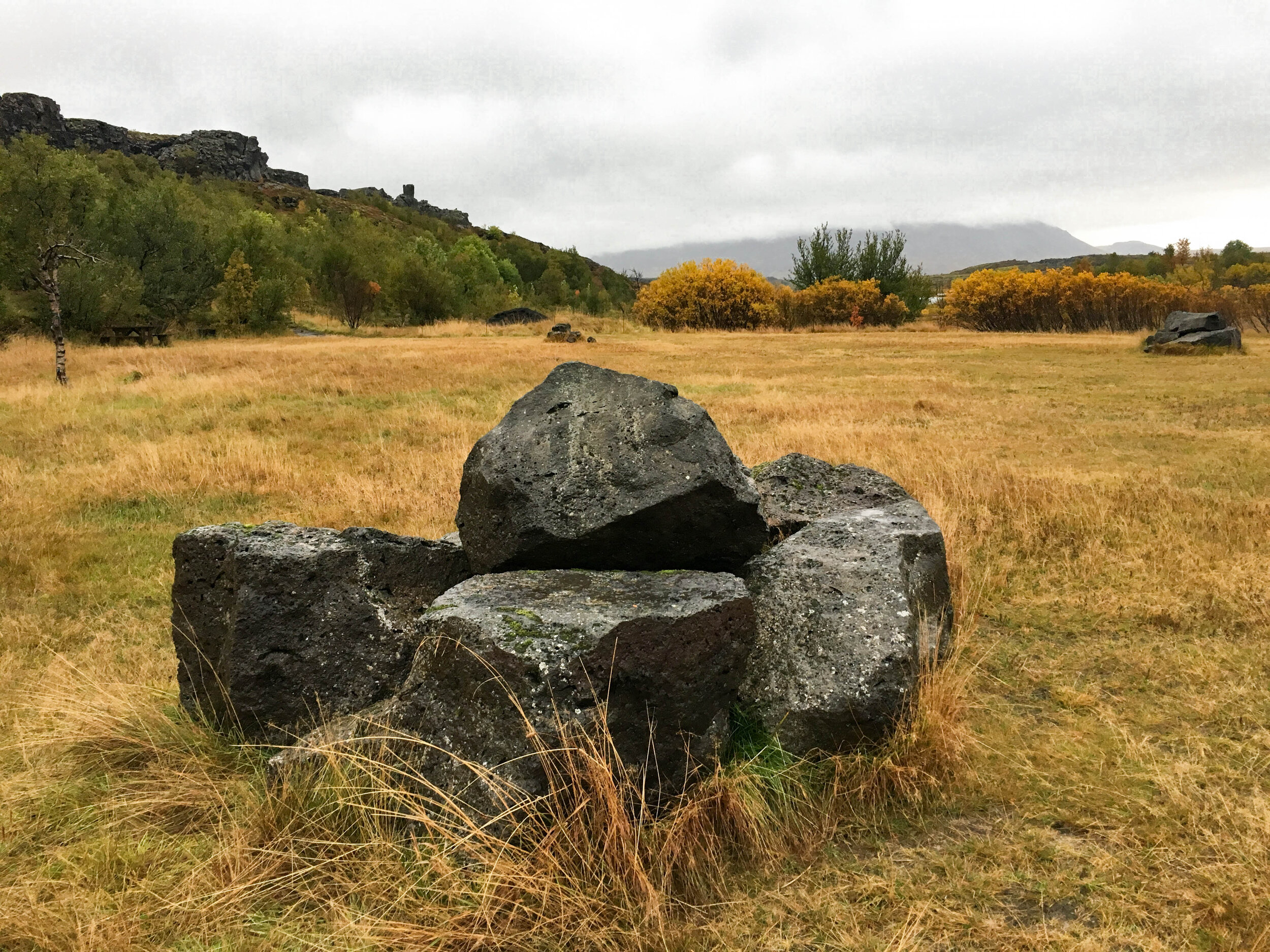
Iceland, as my blog readers may have already noticed, is full of rocks—and many Icelanders believe elves, trolls, and hidden people live in them. There have been several well-documented incidents involving these mystical beings. If you’re curious, check out this video.
Golden-hued lava fields and autumn-colored shrubs followed us along the way.
Gullfoss
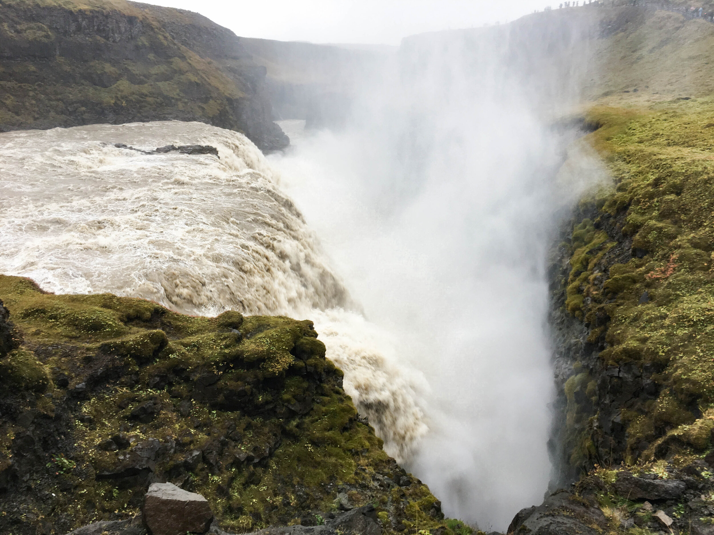
One of Iceland’s most famous waterfalls, dropping into a 70-meter-deep canyon carved by the Hvítá River.
GULL = gold FOSS = waterfall
I believe it’s the seventh-highest waterfall in Iceland.
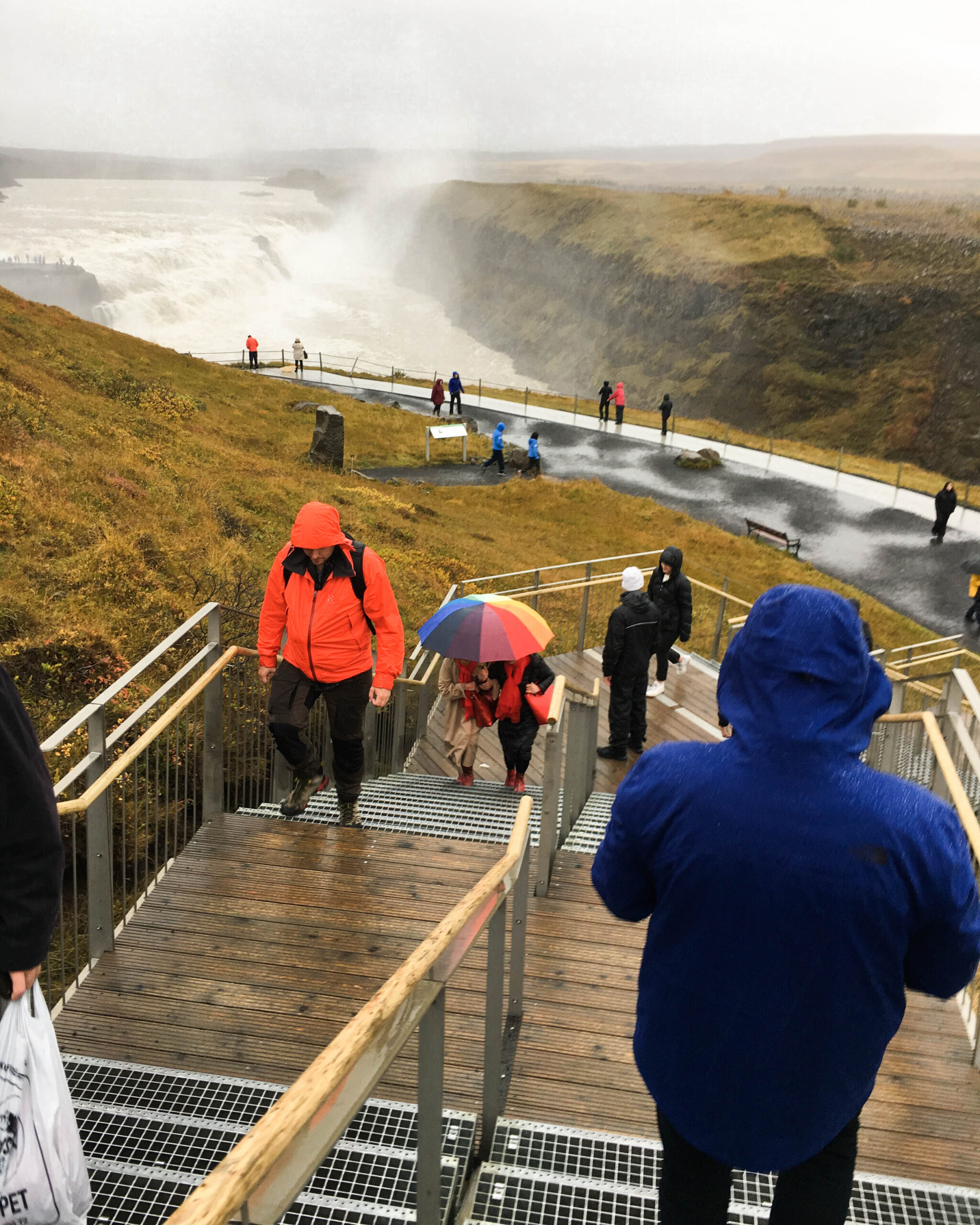
In the foreground, you can see a gentleman carefully shielding his camera under his jacket, while in the background, only the upper section of this magnificent waterfall is visible—a cascade 11 meters high with powerful rapids. In summer, the water flow is around 140 m³/s, but in spring, as glaciers melt, it can surge up to an incredible 2000 m³/s!
I started seeing the rain in a more positive light—it forced me to be present in the moment. Without my camera, I fully soaked in (literally) every second of nature’s raw power. Sometimes, eyes are the best camera!
The image above shows the second cascade—a 21-meter drop. Despite its depth, the mist still reached us 10 meters above.
The Hvítá River originates from the Langjökull glacier and is a popular rafting spot. During my internship at Elding, we went rafting there as part of the end-of-season celebration.
It was the worst experience I had in Iceland: freezing cold water (5°C), no gloves, a sleeveless wetsuit, and a mandatory 6-meter cliff jump. I was so cold my jaw started trembling uncontrollably. To top it off, I “fell” into the water under the raft…
In short—an experience I wouldn’t recommend to anyone.
Geysir
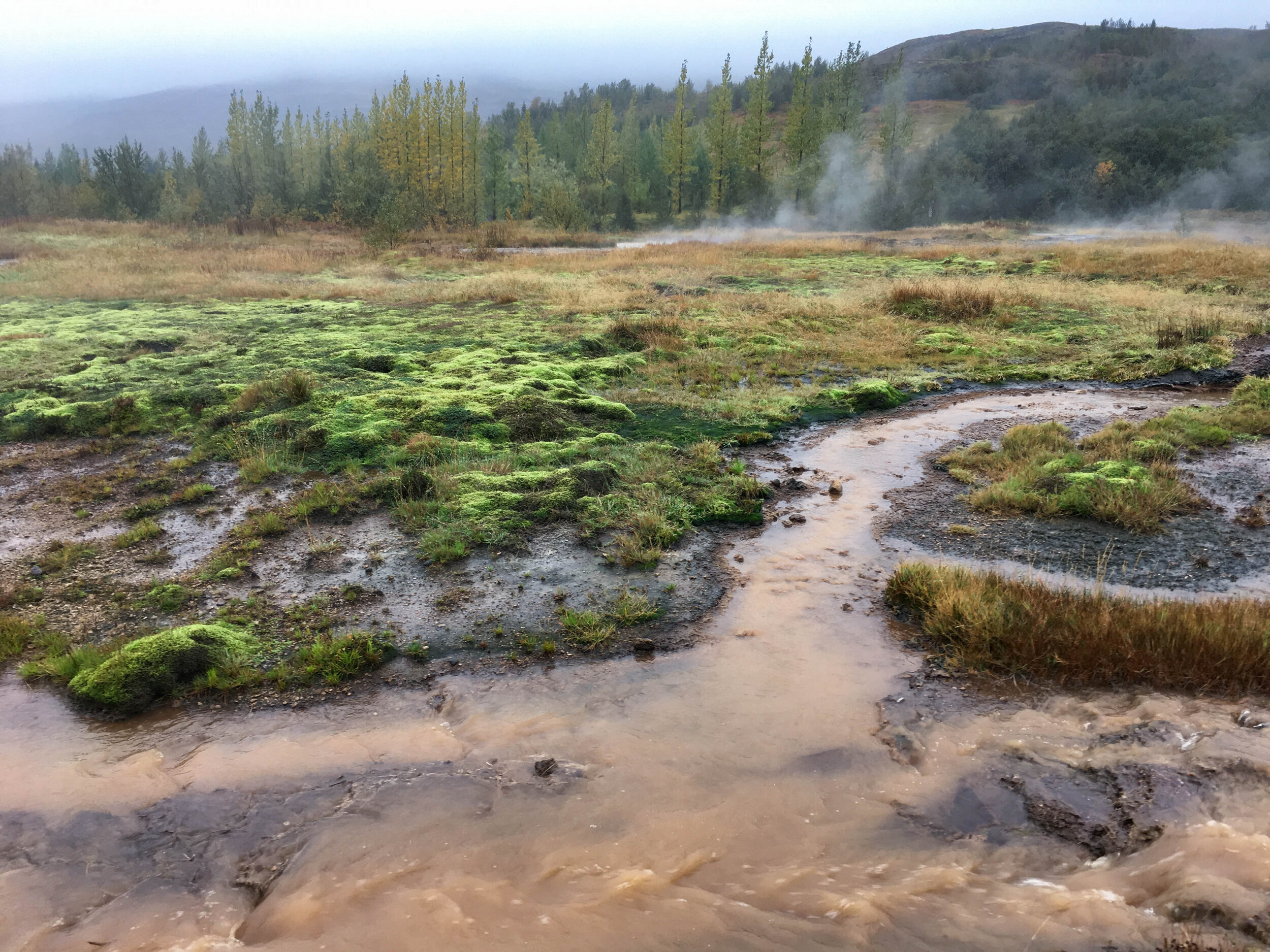
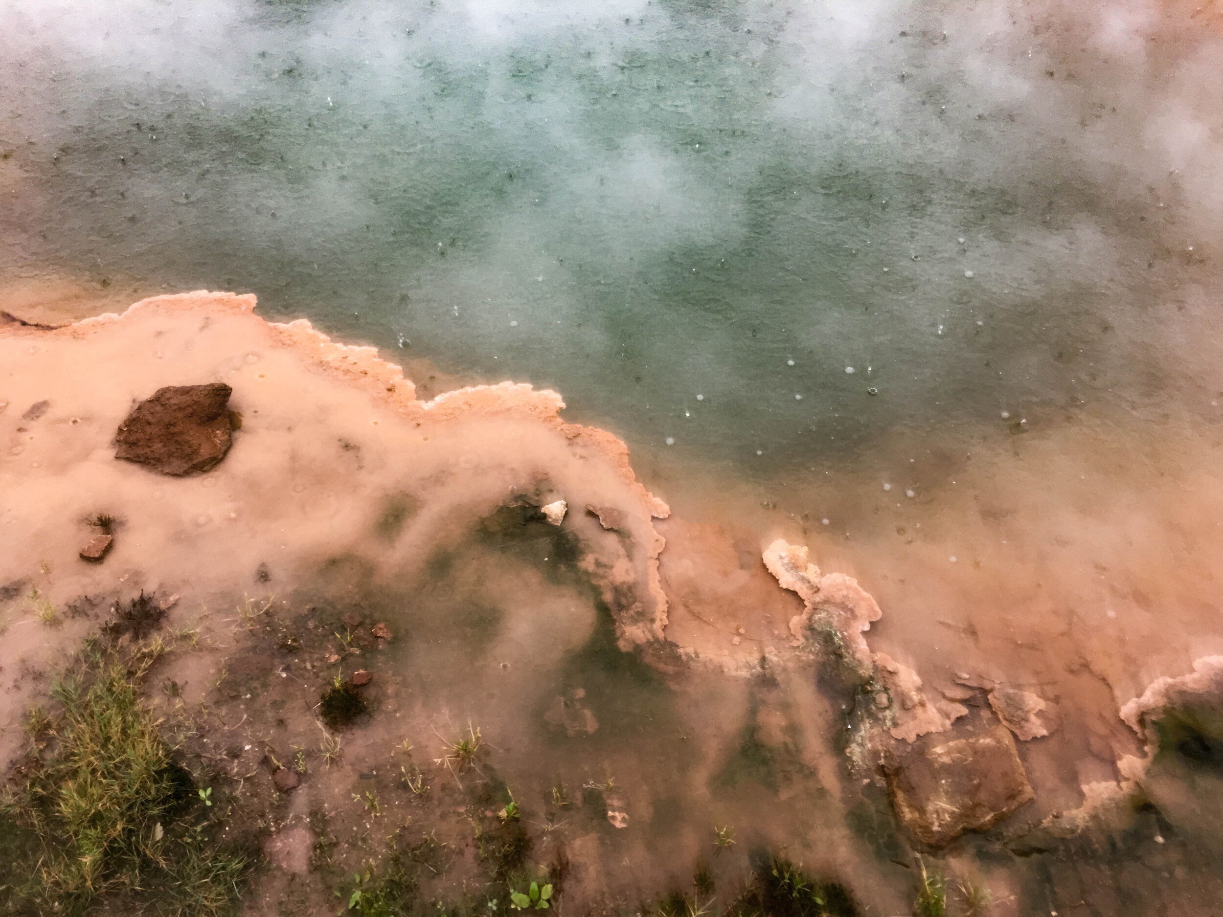
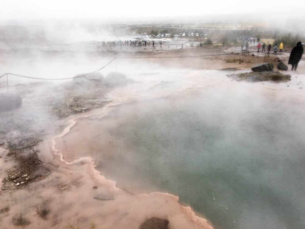
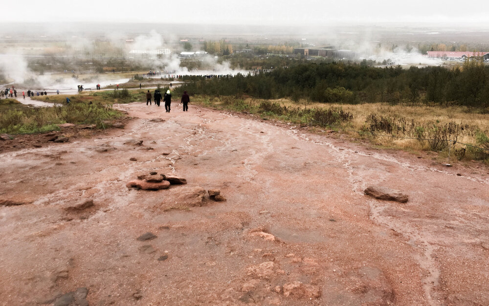
Luckily, our final stop for the day was a geothermal hotspot named after its most famous geyser—Geysir. Fun fact: the word geyser in many languages comes from here (geysir = hot spring).
The area is crisscrossed with small streams that swell when it rains, and steam clouds in the distance hint at their extreme temperatures—most pools range from 80 to 90°C.
Despite numerous warning signs reading “Don’t test the temperature with your hands—it will burn!”, many visitors can’t resist the temptation. And somehow, they survive unscathed!
Everywhere else, the landscape was covered in grass, but here, the colors were completely wild—red, orange, turquoise, yellow—whatever you can imagine. Most of these hues come from algae adapted to the intense heat.
At this point, the rain and being wet became more of a joke.
The most famous geyser here, Strokkur, erupts every 8–10 minutes, shooting water up to 35 meters high. It’s funny watching people gather in a circle, waiting for the explosion. The anticipation is real—everyone wants to capture the moment on camera. I managed to get the shot, only for my phone to die right after… and forget to save the video.
The other major geyser, Geysir, is the one that gave all geysers their name. It only erupts (70–80 meters high) during major earthquakes. The last time was in 2000.
Yeah… Maja and I didn’t read that part, so we stood in the rain for 15 minutes waiting for an eruption that never came.
In the background, you can see steam rising from Strokkur.
DAY 2: South Coast & Jökulsárlón Glacier Lagoon
We had slightly better luck with the weather this day. Well, at least in the beginning…
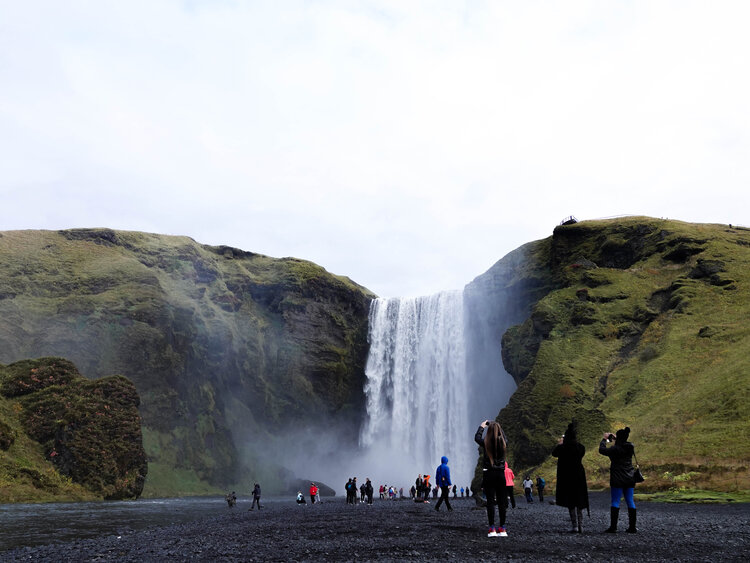
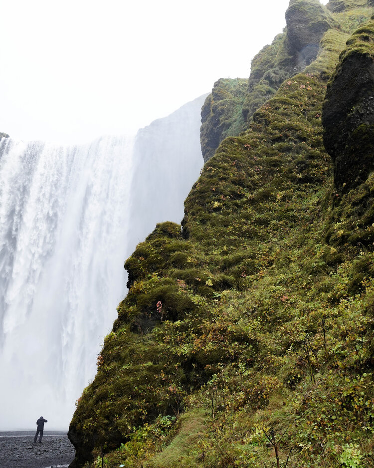
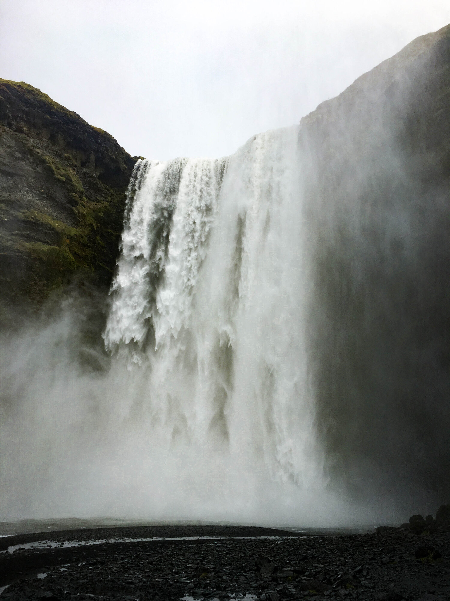
Skógafoss
SKÓGUR = forest
Our first stop was one of Iceland’s most photogenic waterfalls, often used by photographers capturing the northern lights.
I call it the convenient waterfall—it’s located right by the main road that circles Iceland, making it impossible for tourists to just drive past. Its popularity speaks for itself.
When I was here eight years ago, my family and I could take photos in front of the waterfall with no one else in sight.
Today… standing alone in front of the falls is only possible if you’re willing to get close enough to be soaked.
Yes, Iceland’s tourism has nearly quadrupled since then. The waterfall, however, remains unchanged.
The closer to the falls… the fewer people.
I got so close that my camera lens was covered in water droplets, so my phone came in handy. Skógafoss is 62 meters high, making it the fourth-largest waterfall in Iceland. Standing right next to it, it felt even bigger.
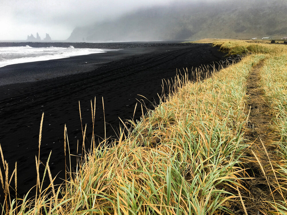
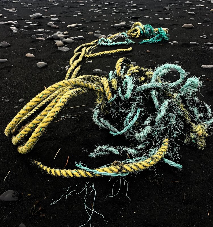
Vík & Black Sand Beach
Our next stop was a three-in-one experience: exploring the black sand beach, visiting the town of Vík, and taking a lunch break.
After two months in Iceland, the town itself didn’t seem particularly remarkable. What I did learn, though, is that Icelandic churches are always built on the safest spot in town—making them the best shelter in case of danger.
The cliffs in the background are a photographer’s favorite. Recently, a landslide hit the area, causing rocks to tumble onto the nearby beach. This section is currently closed, much to the disappointment of many visitors.
Despite the rain greeting us once again, Maja and I loved walking through the “wheat field” and listening to the waves.
Man vs. Nature / Man & Nature?
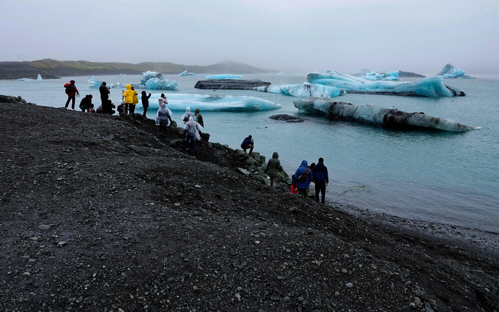
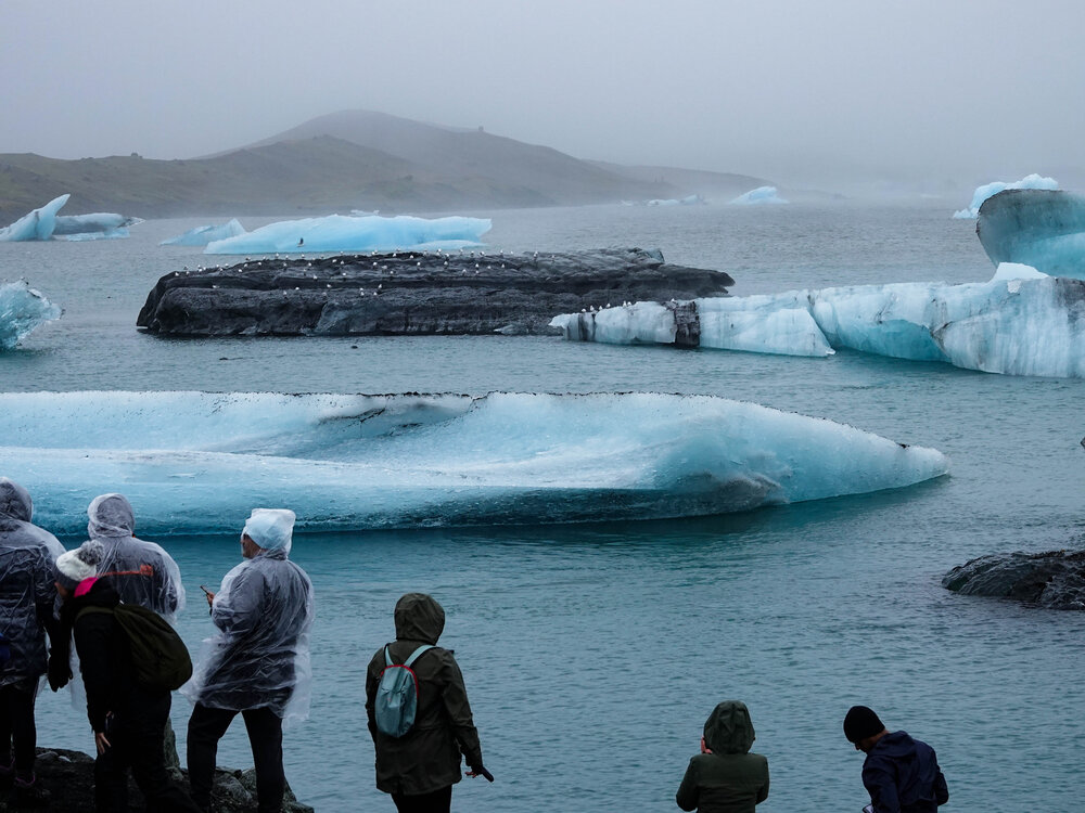
Jökulsárlón Glacier Lagoon
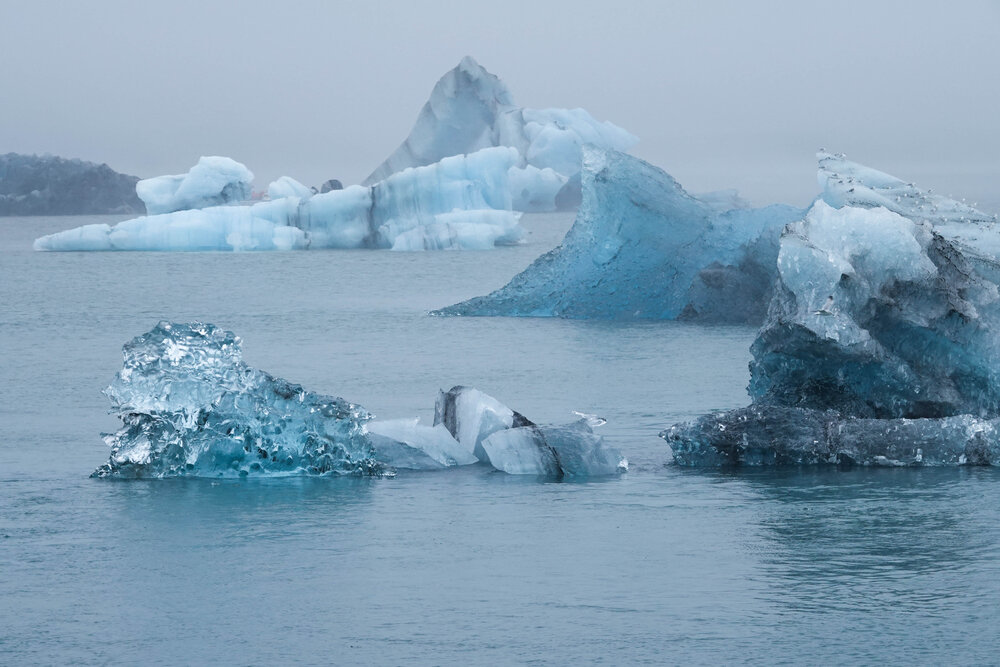
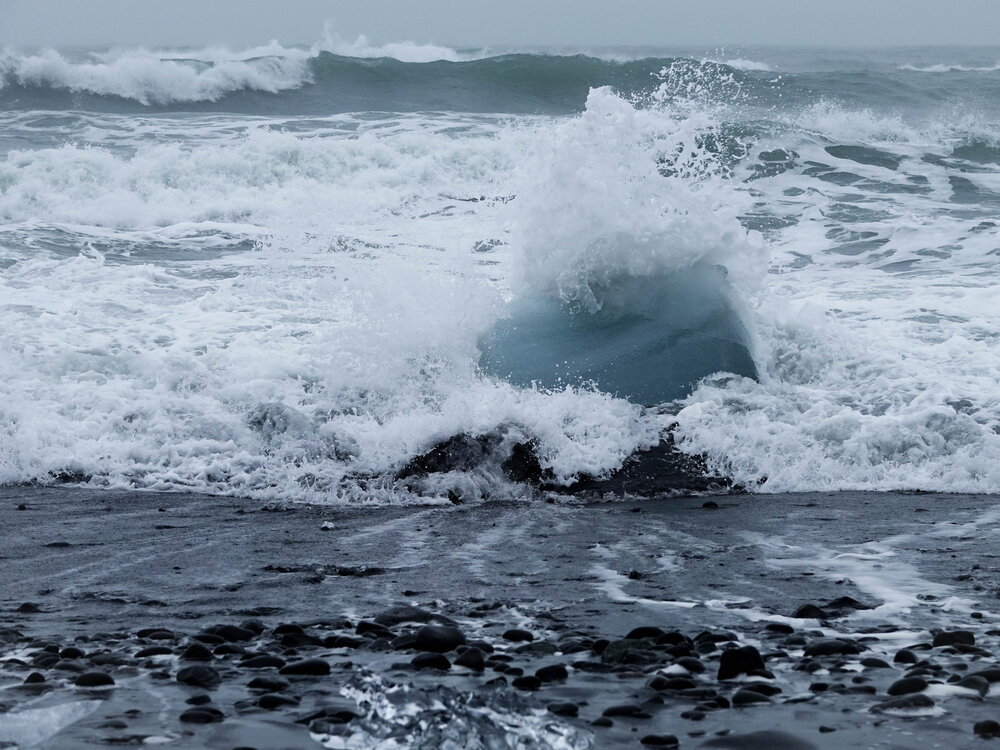
The main highlight of the day was this glacier lagoon. It took us about seven hours to get here, but it was worth every minute—because of the floating ice.
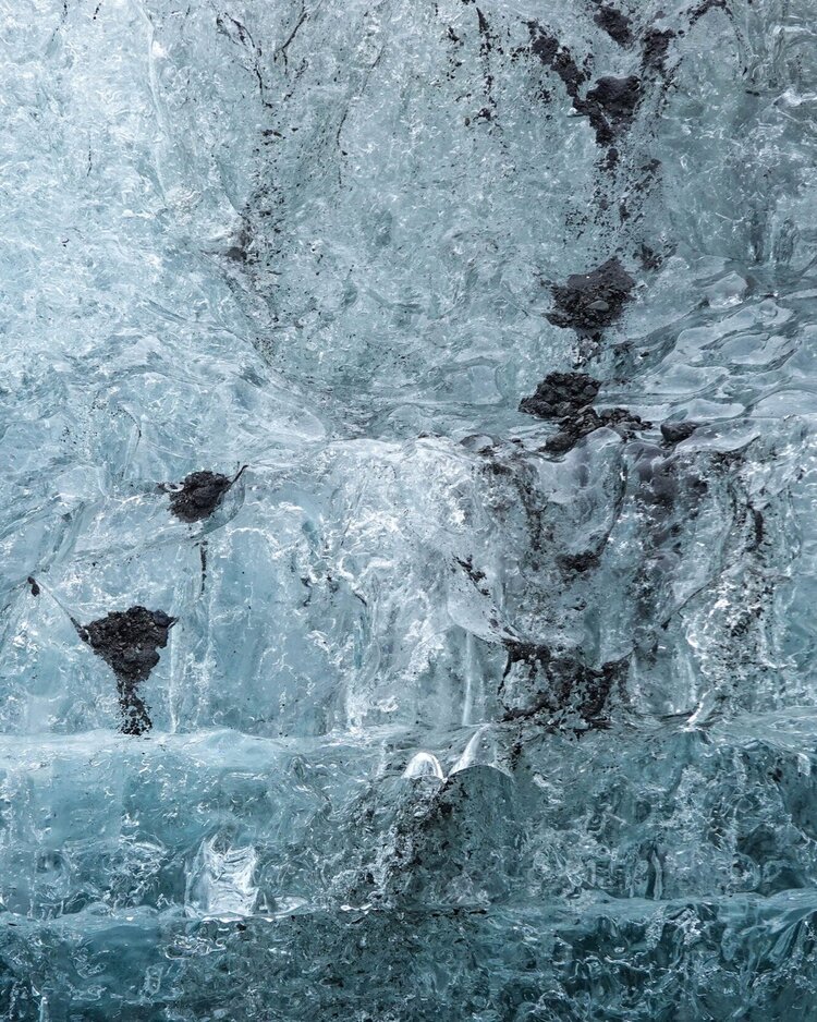
That’s right—just being in the presence of this 1,000-year-old ice, which has broken off from the glacier and holds traces of volcanic ash, is enough for that wow effect.
And the rain? It finally stopped… for ten minutes.
Icelanders say:
“If you don’t like the weather, wait five minutes.” “If you don’t like the landscape, drive a few kilometers away.”
And they couldn’t be more right!
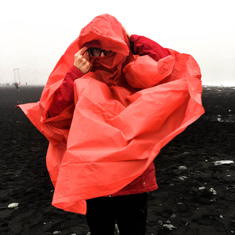
Those with rain ponchos stayed dry. Alenka did not—because her “waterproof” jacket lost its “proof” after 30 minutes.
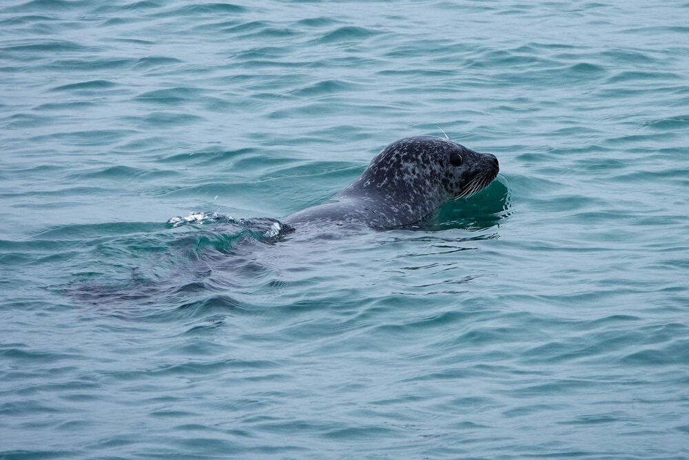
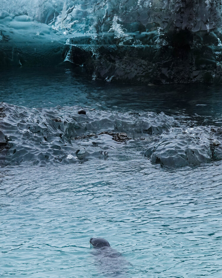
If you look closely beyond the long “iceberg”, you’ll see two little heads.
Two seals! Their gaze was unforgettable.
The good thing about cloudy weather? It keeps the vivid colors of the ice from fading.
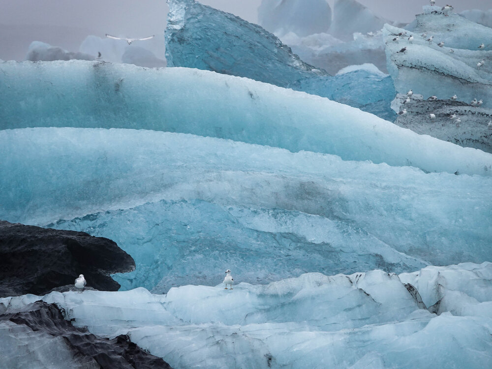
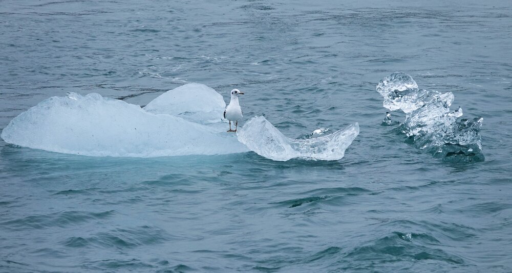
A bird residence. What are seabirds doing here? I’ll tell you soon. 😉
Volcanic sand cascading from ledge to ledge.
Beautiful, isn’t it?
Now, as I sit in my room and look at all these photos, I can’t believe I experienced all this just eighteen days ago. I really tried to take it all in, but an hour and a half was nowhere near enough to absorb the full scale of this place and etch it deep into my memory.
I’ll definitely be back…
They also offer a 20-minute amphibian boat tour around the lagoon. But in this weather? No, thanks. It was raining again.
Meanwhile, Mr. Seagull was having a great time—along with 200 of his feathered friends.
On the other side (the southern end), the lagoon meets the ocean. Maybe the seabirds and seals are drawn here by the abundance of fish in these mixing waters.
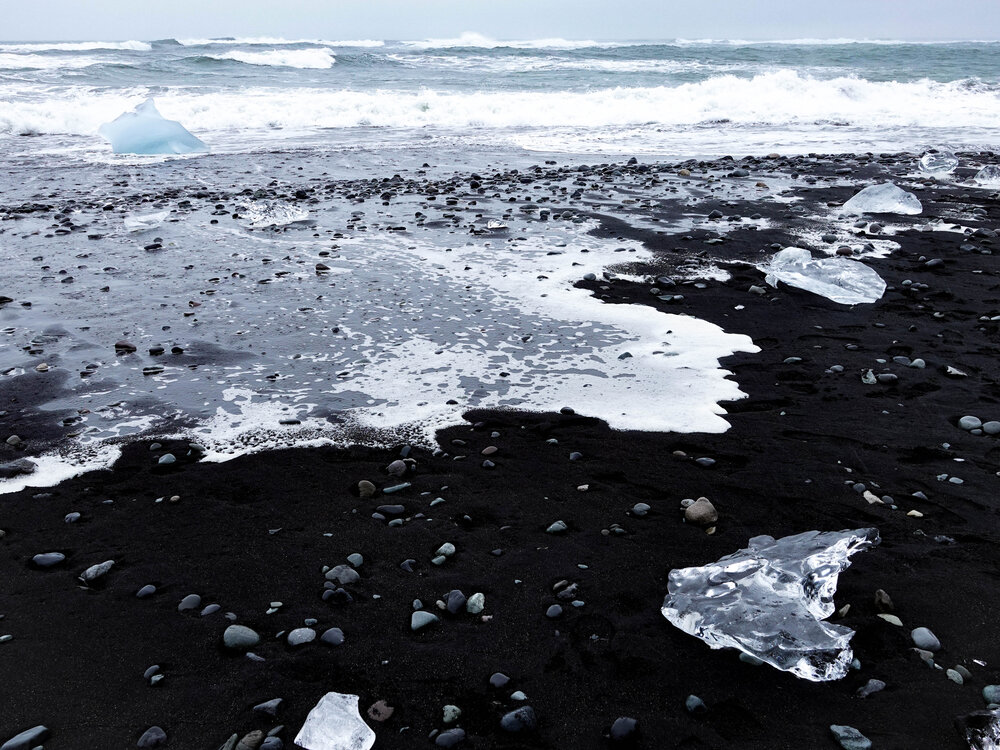
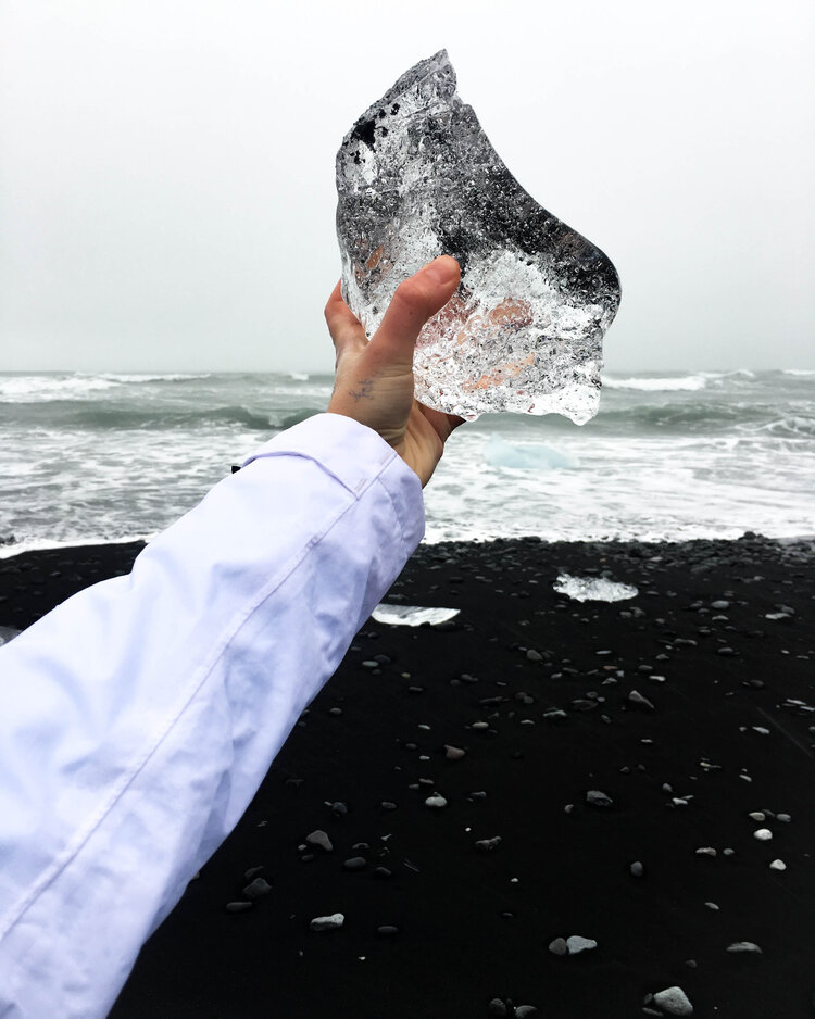
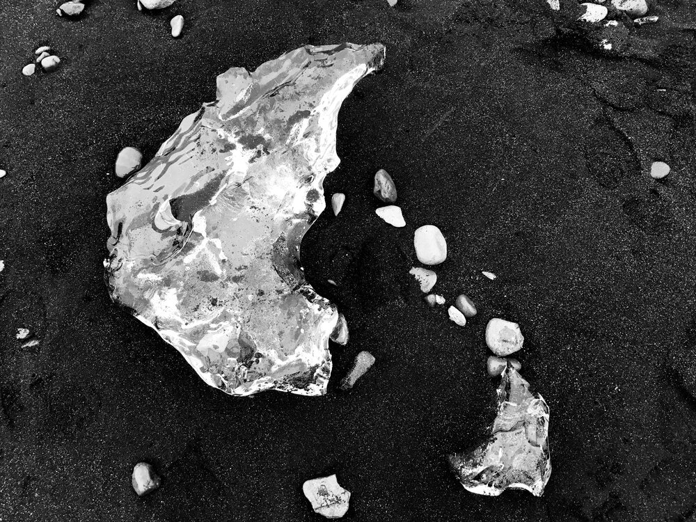
The beach on the far side is called “Diamond Beach” because of the countless ice chunks washed ashore, resembling scattered diamonds. In colder months, there are even more of them.
Maja, a.k.a. The Icelandic Warrior Against Rain.
These beaches can be dangerous due to the extreme difference between high and low tide—the water quickly floods the gentle slope and can easily sweep away an overly bold tourist.
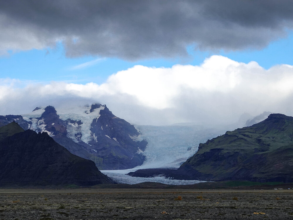
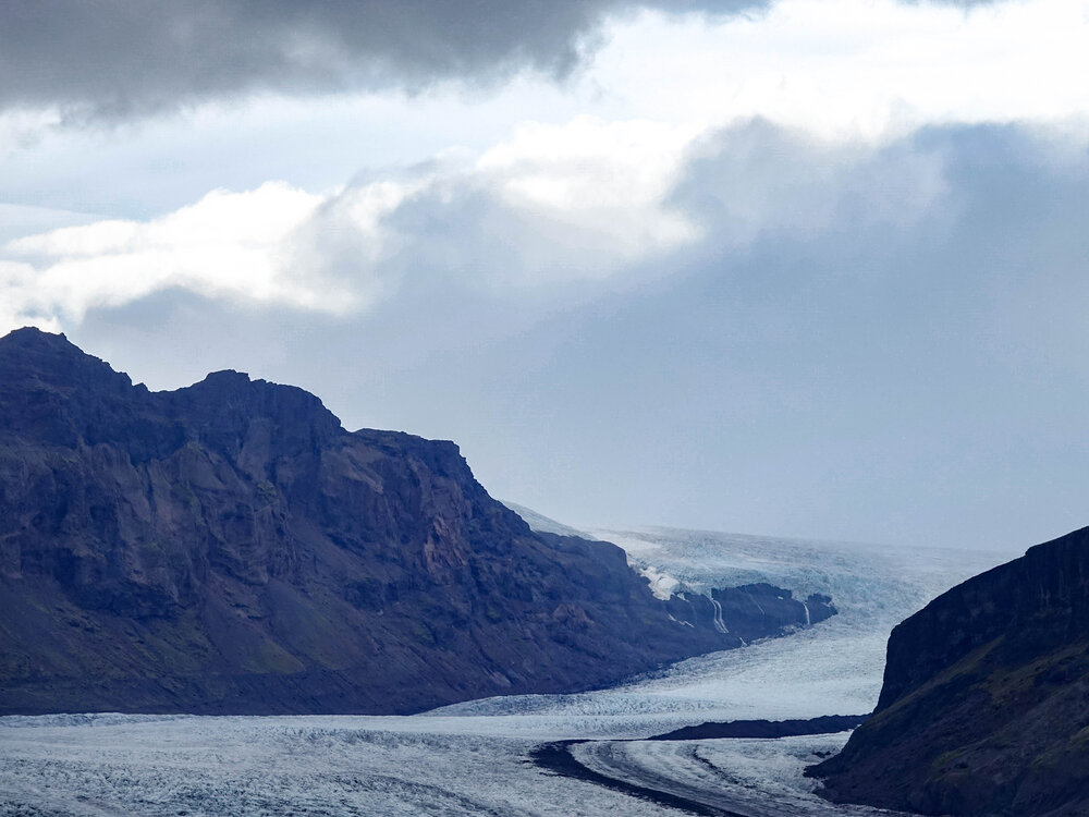
After our rainy stop, we rewarded ourselves with a bonus location offering a panoramic view of the mighty glaciers.
One of them was a glacier tongue of Vatnajökull, Iceland’s largest glacier, which also feeds the lagoon we had visited earlier.
From this distance, it’s hard to grasp the sheer scale of these glaciers. But compared to the massive waterfalls in the background, you start to realize just how enormous these ice masses truly are.
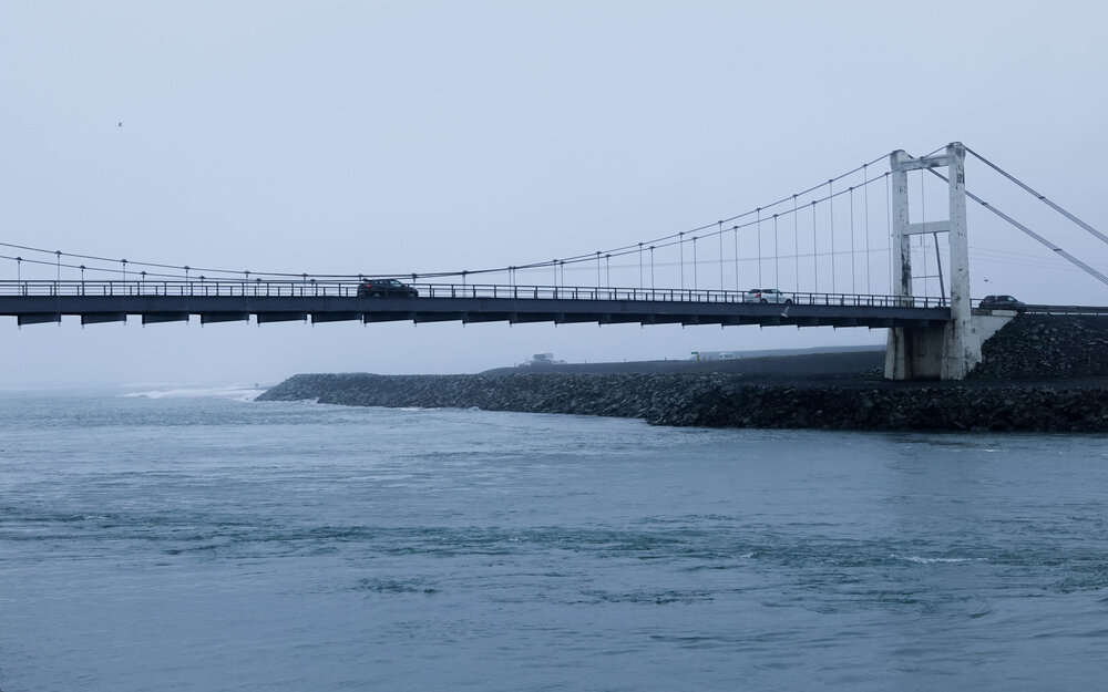
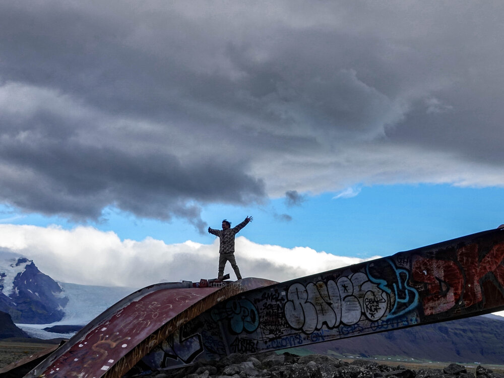
Gígjukvísl
Nearby stands a bridge—what’s left of it, at least. It was swept away by a tsunami-like flood in 1996.
What remains is a sculpture made from two pieces of the bridge that once stood a few hundred meters away.
The guys in our group decided to climb to the top. But they didn’t anticipate one thing—at the bottom of their makeshift slide was a massive puddle. One by one, they landed in it, soaking themselves up to their knees.
Oops.
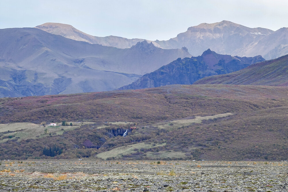
The landscape here already had a late-autumn look, which made it even funnier when I arrived in early-autumn Slovenia. It felt like traveling back in time. Not bad at all.
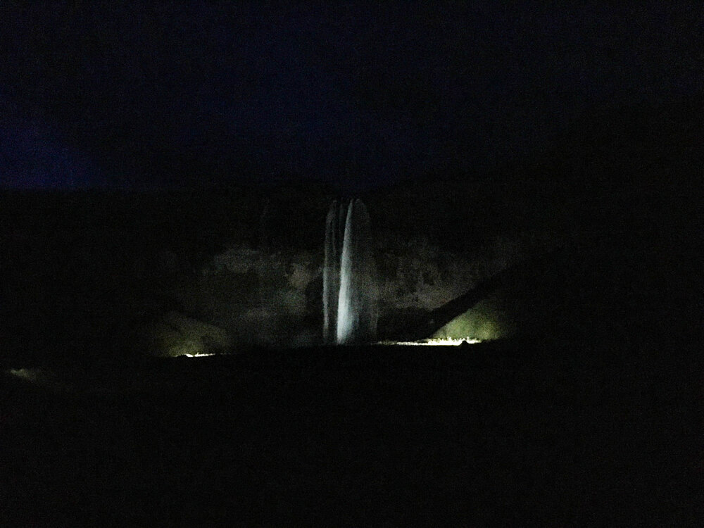
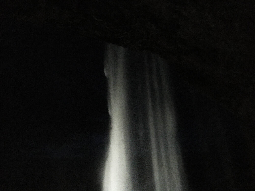
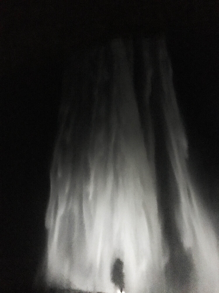
Seljalandsfoss
The Seljalandsá River cascades over a 60-meter-high cliff, originating from the Eyjafjallajökull glacier—the same one that caused chaos in air travel when its volcano erupted in 2010.
We knew this waterfall was on the itinerary, but we couldn’t figure out how we’d see it so late in the day, after dark. Did they forget about it?
Upon arrival around 8 PM, the answer became clear—it was illuminated!
Wow!
Seljalandsfoss is famous because you can walk behind it. Our guide warned us we’d get wet, so we hesitated at first. But we went anyway…
Best decision of the evening.
It was absolutely breathtaking. And completely empty.
Someone else stood behind the falls, probably just as mesmerized as we were.
And that’s how my (our) last Wednesday in Iceland ended.
On the drive back to Reykjavík, Maja and I waited for the northern lights… but no luck.
One more reason to return to this magical country—just like I know I will.